- Maailman
- »
- US
- »
- Florida
- »
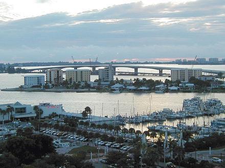
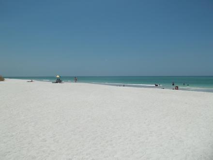
- Pinecraft, Florida
Yrityksiä paikoissa Pinecraft
| Pinta-ala kohteesta Pinecraft, Florida | 62,03 mi² |
| Väestö | 90 754 |
| Miesväestö | 43 277 (47,7 %) |
| Naisväestö | 47 477 (52,3 %) |
| Väestön muutos vuodesta 1975 vuoteen 2015 | +93,9 % |
| Väestön muutos vuodesta 2000 vuoteen 2015 | +23,7 % |
| Keski-ikä | 48,3 |
| Miesten keski-ikä | 46,4 |
| Naisten keski-ikä | 50 |
| Paikallinen aika | torstaina 23.13 |
| Aikavyöhyke | Yhdysvaltain itäinen kesäaika |
| Leveys- ja pituusaste | 27.32505° / -82.49121° |
Pinecraft, Florida - Kartta
Pinecraft, Florida Väestö
Vuodesta 1975 vuoteen 2015| data | 1975 | 1990 | 2000 | 2015 |
|---|---|---|---|---|
| Väestö | 46 802 | 57 599 | 73 395 | 90 754 |
| Väestötiheys | 754,5 / mi² | 928,5 / mi² | 1 183 / mi² | 1 463 / mi² |
Pinecraft Väestön muutos vuodesta 2000 vuoteen 2015
23,7 % nousu vuodesta 2000 vuoteen 2015| Sijainti | Muutos vuodesta 1975 | Muutos vuodesta 1990 | Muutos vuodesta 2000 |
|---|---|---|---|
| Pinecraft, Florida | +93,9 % | +57,6 % | +23,7 % |
| Sarasota Springs | +93,8 % | +57,5 % | +23,7 % |
| Florida | +95,6 % | +51,7 % | +26,2 % |
| Yhdysvallat | +46,9 % | +27,2 % | +13,7 % |
Pinecraft, Florida Keski-ikä
Keski-ikä: 48,3 vuotta| Sijainti | Keski-ikä | Mediaani-ikä (nainen) | Mediaani-ikä (mies) |
|---|---|---|---|
| Pinecraft, Florida | 48,3 vuotta | 50 vuotta | 46,4 vuotta |
| Sarasota Springs | 44,5 vuotta | 46,4 vuotta | 42,5 vuotta |
| Florida | 41,8 vuotta | 43,2 vuotta | 40,4 vuotta |
| Yhdysvallat | 37,4 vuotta | 38,7 vuotta | 36,1 vuotta |
Pinecraft, Florida Väestöpuu
Väestö iän ja sukupuolen mukaan| Ikä | Mies | Nainen | Kaikki yhteensä |
|---|---|---|---|
| Alle 5 | 1 934 | 1 887 | 3 821 |
| 5-9 | 2 198 | 2 147 | 4 345 |
| 10-14 | 2 634 | 2 466 | 5 100 |
| 15-19 | 2 698 | 2 359 | 5 058 |
| 20-24 | 2 021 | 1 890 | 3 911 |
| 25-29 | 2 164 | 2 027 | 4 192 |
| 30-34 | 2 023 | 2 002 | 4 025 |
| 35-39 | 2 365 | 2 424 | 4 789 |
| 40-44 | 2 719 | 2 904 | 5 623 |
| 45-49 | 3 172 | 3 663 | 6 835 |
| 50-54 | 3 315 | 3 749 | 7 064 |
| 55-59 | 3 070 | 3 595 | 6 666 |
| 60-64 | 3 053 | 3 572 | 6 625 |
| 65-69 | 2 737 | 3 235 | 5 972 |
| 70-74 | 2 324 | 2 768 | 5 093 |
| 75-79 | 1 978 | 2 373 | 4 352 |
| 80-84 | 1 547 | 2 097 | 3 645 |
| 85 Plus | 1 325 | 2 321 | 3 646 |
Pinecraft, Florida Väestötiheys
Väestötiheys: 1 463 / mi²| Sijainti | Väestö | alue | Väestötiheys |
|---|---|---|---|
| Pinecraft, Florida | 90 754 | 62,03 mi² | 1 463 / mi² |
| Sarasota Springs | 15 046 | 3,625 mi² | 4 151 / mi² |
| Florida | 20,3 miljoonaa | 65 757,5 mi² | 308,1 / mi² |
| Yhdysvallat | 321,6 miljoonaa | 3 796 761,2 mi² | 84,7 / mi² |
Pinecraft, Florida Väestö ennen ja tulevaisuudessa
Arvioitu väestö vuodesta 1890 vuoteen 2100Sources:
1. JRC (European Commission's Joint Research Centre) work on the GHS built-up grid
2. CIESIN (Center for International Earth Science Information Network)
3. [Linkki] Klein Goldewijk, K., Beusen, A., Doelman, J., and Stehfest, E.: Anthropogenic land use estimates for the Holocene – HYDE 3.2, Earth Syst. Sci. Data, 9, 927–953, https://doi.org/10.5194/essd-9-927-2017, 2017.
Inhimillisen kehityksen indeksi (HDI)
Tilastollinen yhdistetty indeksi elinajanodosta, koulutuksesta ja tuloista henkeä kohti.Sources: [Link] Kummu, M., Taka, M. & Guillaume, J. Gridded global datasets for Gross Domestic Product and Human Development Index over 1990–2015. Sci Data 5, 180004 (2018) doi:10.1038/sdata.2018.4
Pinecraft, Florida CO2-päästöt
Hiilidioksidipäästöt (CO2) asukasta kohden tonneina vuodessa| Sijainti | Hiilidioksidipäästöt | Hiilidioksidipäästöt asukasta kohden | Hiilidioksidipäästöjen intensiteetti |
|---|---|---|---|
| Pinecraft, Florida | 1 701 012 am. tn | 18,7 am. tn | 27 421 am. tn/mi² |
| Sarasota Springs | 253 606 am. tn | 16,9 am. tn | 69 968 am. tn/mi² |
| Florida | 302 482 609 am. tn | 14,9 am. tn | 4 599 am. tn/mi² |
| Yhdysvallat | 5 664 619 809 am. tn | 17,6 am. tn | 1 491 am. tn/mi² |
Pinecraft, Florida CO2-päästöt
| 2013 CO2-päästöt (tonnia/vuosi) | 1 701 012 am. tn |
| 2013 CO2-päästöjä (tonnia/vuosi) asukasta kohden | 18,7 am. tn |
| 2013 CO2-päästöjen intensiteetti (tonnia/mi²/vuosi) |
Luonnollisten vaarojen riski
Suhteellinen riski kymmenestä| sykloni | Korkea (7) |
| Tulva | Korkea (7) |
* Erityisesti tulvaan tai maanvyörymiin liittyvät riskit eivät ehkä kata koko aluetta.
Sources: 1. Dilley, M., R.S. Chen, U. Deichmann, A.L. Lerner-Lam, M. Arnold, J. Agwe, P. Buys, O. Kjekstad, B. Lyon, and G. Yetman. 2005. Natural Disaster Hotspots: A Global Risk Analysis. Washington, D.C.: World Bank. https://doi.org/10.1596/0-8213-5930-4.
2. Center for Hazards and Risk Research - CHRR - Columbia University, Center for International Earth Science Information Network - CIESIN - Columbia University. 2005. Global Flood Hazard Frequency and Distribution. Palisades, NY: NASA Socioeconomic Data and Applications Center (SEDAC). https://doi.org/10.7927/H4668B3D.
3. Center for Hazards and Risk Research - CHRR - Columbia University, Center for International Earth Science Information Network - CIESIN - Columbia University, International Bank for Reconstruction and Development - The World Bank, and United Nations Environment Programme Global Resource Information Database Geneva - UNEP/GRID-Geneva. 2005. Global Cyclone Hazard Frequency and Distribution. Palisades, NY: NASA Socioeconomic Data and Applications Center (SEDAC). https://doi.org/10.7927/H4CZ353K.

Tietoja tietomme
Tämän sivun tiedot on arvioitu käyttämällä useita julkisesti saatavilla olevia työkaluja ja resursseja. Se toimitetaan ilman takuuta, ja se voi sisältää epätarkkuuksia. Käytä omalla vastuullasi. Katso tästä lisätietoja.